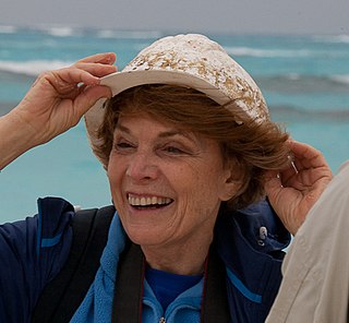
Explore popular quotes and sayings by an American scientist Sarah Parcak.
Last updated on December 23, 2024.
Looting and site destruction are global problems. We have a tough road ahead, and one key will be developing more collaborations and using new technologies like satellite imagery.
What if Hiram Bingham had the technology to find hundreds of other archaeological sites at the same time and create entire 3-D maps of the ancient landscape accurate to within a few inches?
I can't tell you the number of times I've been walking over an archaeological site. And you can't see anything on the ground, and pull back hundreds of miles in space, and all of a sudden you can see streets and roads and houses and even pyramids.
Choosing an unconventional career path - I am not a traditional Egyptologist by any means. I found what I love, and I have stuck with it.
What is amazing to me as an archaeologist is that the more and more I study, I realize we are resilient, we are creative, we are brilliant, and this is what makes us human, and that hasn't changed since we've been human.
Seeing sites and features in places where we never looked or never thought things might exist is causing archaeologists across the world to think deeper about their sites or entire cultures.
What these satellites do is they record light radiation that's reflected off the surface of the Earth in different parts of the light spectrum. We use false color imaging to try to tease out these very subtle differences on the ground.
If you find a series of linear shapes in the same alignment as known archaeological features, and they match excavated examples, you still need to excavate to confirm, but you can be fairly sure that the imagery is accurate.
Think about what would happen if Indiana Jones and Google Earth had a love child. I use high-resolution and NASA satellites and look for subtle differences on the surface of the earth that locate buried ancient pyramids and towns and ancient tombs, which we then go and excavate.
Scorpions like holes. We had to put our arms in the holes to dig out the smelting residues. We always performed critter checks before an excavation, but one morning, I put an arm in and felt a sharp pierce. When I brought my hand out, it was red and already swelling.
Looting speaks to a lack of economic opportunities - frankly, we all would loot, too, if our families' continued survival depended on it.
The majority of the research I do is archaeological research, but to me, as a professor, the most important thing is to encourage and mentor students.
Satellite datasets like WorldView can see objects as small as 1.5 feet in diameter. In 2014, WorldView-3 will be able to see objects a small as a foot.
Google Earth is an incredible resource because from hundreds of miles in space, we can zoom in, and we can find things. Everyone always looks for their house first. That is the tip of the iceberg with remote sensing.
You can theorize as much as you want about what you think you're seeing, but until you get out there and dig, you can't tell exactly what it is.
The most exciting moment as an archaeologist happened when I was looking at the great archaeology site of Tannis, which of course we all know from 'Indiana Jones.' We got satellite imagery of the city of Tannis, we processed it, and literally from thousands of miles away from my lab in Alabama, we were able to map the entire city.
Once archaeologists have shown possible 'new' ancient features, they can import the data into their iPads and take it to the field to do survey or excavation work. Technology doesn't mean we aren't digging in the dirt anymore - it's just that we know better where to dig.
We have so many thousands of sites to find across the globe and new techniques to test. The field keeps evolving with the technology, which makes things exciting.
I've found numerous things - settlements, temples, possible pyramids, forts, roads - the list goes on and on. I'm not as interested in the discoveries as the types of questions they help us formulate.
Archaeologists use datasets from NASA and commercial satellites, processing the information using various off-the-shelf computer programs. These datasets allow us to see beyond the visible part of the light spectrum into the near, middle, and far infrared.
Satellite imagery is the only way we can map the looting patterns effectively.
WorldView-3 goes into the mid-infrared wavelength, allowing you to see very subtle geological differences on the sites at a 0.4-metre resolution.
The map we made of the 3,000-year-old city of Tanis requires no imagination. It has buildings, streets, admin complexes, houses - clear as day.
I am part of a network of people monitoring what's happening at ancient sites in Iraq and Syria - from space. We can see clearly the destruction.
We only have a limited amount of time left before many archaeological sites all over the world are destroyed. So we have to be really selective about where we dig.
I try to tell a lot of stories to make my students aware that the world is a very cool place with many problems that need solving, and that they all can help solve them.
Imagery is powerful. Imagery is provocative - satellite imagery much more so because it is from space, and it allows us to get this perspective that we don't have to have otherwise.
Looting has an immense impact on our ability to understand our global cultural heritage; once these objects are gone, so too is our chance of piecing together humanity's shared story.
I've always loved teaching and reading and talking to people, and my grandfather was a professor.
I'm an Egyptologist. I'm a remote sensing specialist, and I'm a space archaeologist.
I played varsity soccer at Yale and continued playing at Cambridge.
The most exciting part of what I do is understanding the scale of what we don't know. There are just countless archaeological sites all over the world, and one of the most important and best ways of finding them is using digital technology.
Satellites record data in different parts of the light spectrum that we can't see. And it's that information that allows satellites to be so powerful in terms of looking at things like vegetation health, finding different kinds of geology that may indicate an oil deposit or some kind of mineralogical deposit that can be mined.